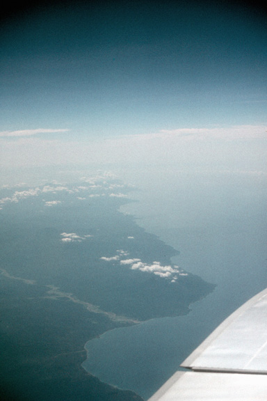
ABOVE THE BANDA SEA -- Seram is part of the Molucca (or Spice) Islands. I never got the chance to go to New Guinea or the Moluccas while I was there. I hope to correct that someday. I believe this is the Bobot River where it flows into the Banda Sea.
Now I see Ceram [Seram] and the Gorong Islands. Oh, it's 0730 hrs. Jakarta time. The [Seram Sea and] Banda Sea [are] pretty shallow. I can see lots of reefs. This is on the N coast of Ceram. I can see Bemu (more or less) on the S. coast. Ceram and Ambon look sparsely inhabited. These maps I have don't do justice to the size of the archipelago. We've just passed over Ambon and still have 2-1/2 hours to go!
Banda Sea: 11,900 m altitude, WSW of Ambon: Saw Ambelau and Buru islands. May have gotten a glipmpse of Mt. Kaplamada (2,736 m). [Mt. Kaplamada is in the northwest part of Buru.]
Questions? Comments? E-mail me.